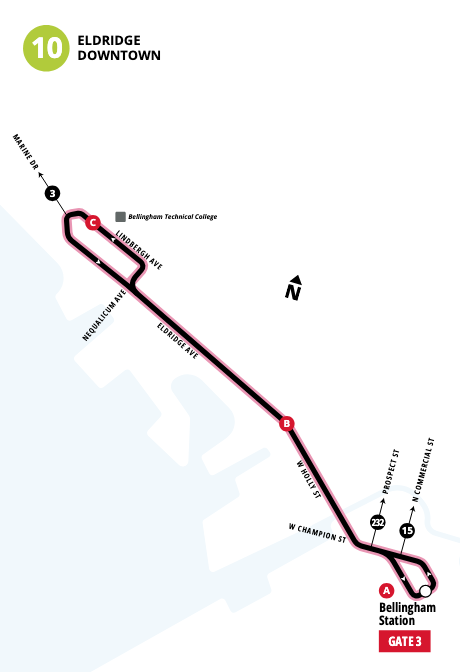
An Atypical Loop of Bellingham Using Some of WTA’s New Bus Routes

Checking out the new Routes 9, 10, and 18, introduced as part of June's service expansion.

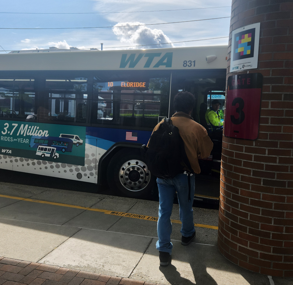
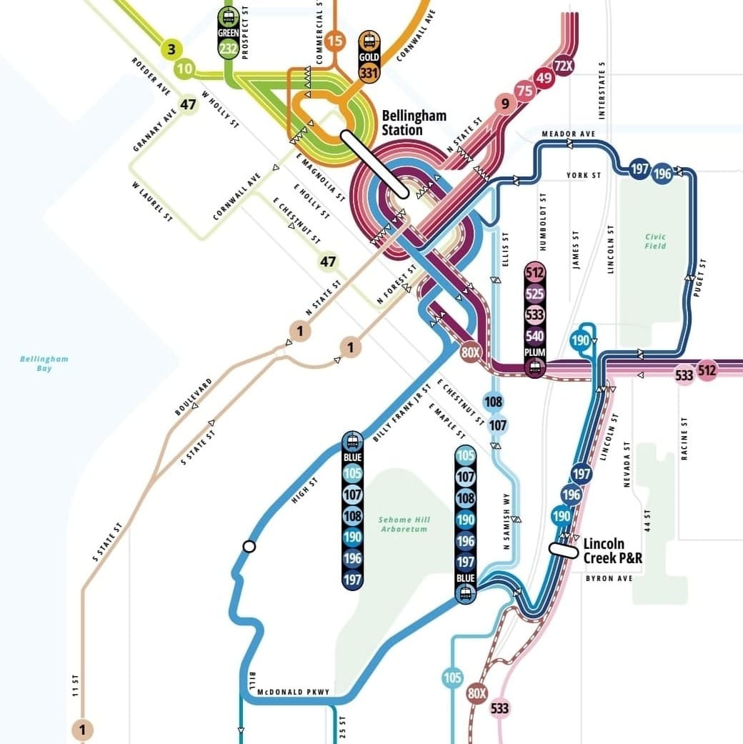
Last week, I had Thursday and Friday off of work, so I used it as an opportunity to check out some of the Whatcom Transit Authority’s expanded bus service around town, which went into effect on June 15. While this month’s service changes boosted some weekend service, including new Sunday service for Route 3 (Downtown/Airport/Cordata), I wanted to see the fruits of WTA increasing weekday service frequency along two corridors in Bellingham — W. Holly Street through Old Town and James Street through Sunnyland — with two new routes, the 9 (Downtown/Hospital) and 10 (Eldridge).
When you add in the new Route 18 (Hospital/Cordata) plus Route 3, it forms an atypical, misshapen, north-northwestern oriented loop anchored by Bellingham Station in Downtown Bellingham. Unlike the Green and Gold GO Line’s defacto frequent-service loop formed by Routes 232 and 331, you wouldn’t use this combined Route 3, 9, 10, and 18 circle tour to go anywhere quickly nor directly.
But this clockwise transit tour of Bellingham not only offers an opportunity to check out some of June’s service changes but also assess some important local transit development progress that will likely be overlooked by many Bellinghamsters.
Route 10 (or 3) to Little Squalicum via Old Town
Back in April when the renovated Little Squalicum Pier opened to the public, I noted in a newsletter-blog edition that transit access to and from the City of Bellingham’s newest waterside destination would vastly improve come June when WTA introduced its service expansion. Well, Route 10 is now here and WTA buses will get you out to Little Squalicum Park in about 10 minutes.
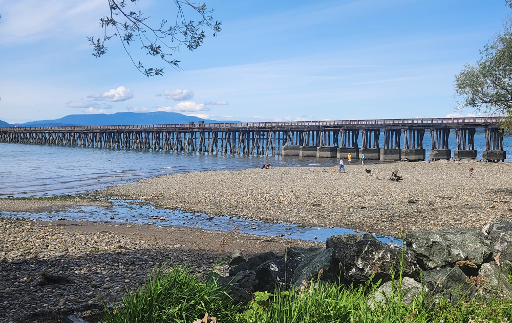
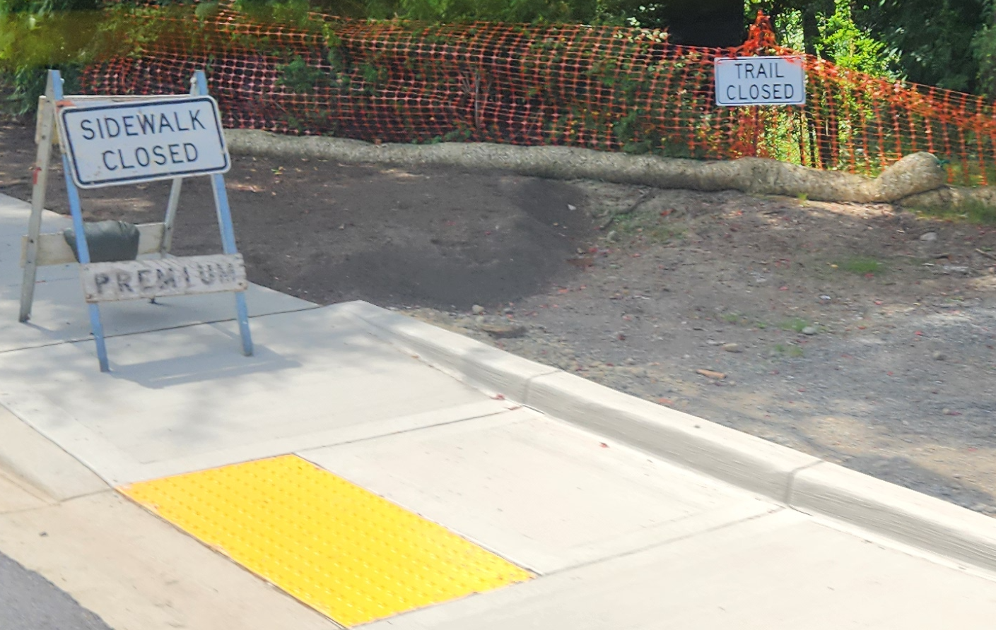
Normally, Routes 3 and 10 both stop at Lindbergh Avenue & Eldridge Avenue, which is a short walk from Little Squalicum Pier. But the city’s ongoing construction near Bellingham Technical College, part of the Little Squalicum Creek water quality improvements, has part of Lindbergh Avenue currently closed to traffic, so I walked over from WTA’s bus stop at BTC’s campus.
Little Squalicum Park was full of dogwalkers, parkgoers, and pierwalkers. The views of Bellingham Bay and Lummi Island were great. It’s a great local parks destination, but a spot some Bellinghamsters bemoan visiting because parking isn’t immediately adjacent to the beach area, which requires a walk to reach.
My main observation with the new Route 10 isn’t simply about the 10, which on paper is a fairly simple weekday-only route that comes once an hour. But when the 10’s hourly service is combined with Route 3’s hourly service along W. Holly Street and Eldridge Avenue, it creates a transit corridor between Downtown Bellingham and Bellingham Technical College through Old Town and the southern part of the Columbia neighborhood with a bus every 30 minutes. Since the City of Bellingham and local housing partners are in the process of developing hundreds of new apartments on eight blocks in the Old Town Urban Village, the additional weekday service will help support the new housing density and, hopefully, boost commercial vitality along some of the sleepier parts of W. Holly Street in the years to come.
While a bus every 15 minutes through the heart of a denser Old Town would be better than a bus every 30 minutes, the Gold GO Line’s frequent Route 232 service on Dupont Street isn’t too far away. And when Route 47 (Harbor) just across the railroad tracks on Roeder Avenue, which now features bus service every 30 minutes, is factored in, Old Town is now one of Bellingham’s more transit-accessible neighborhoods.
- Watch a WTA video about Routes 3 and 10 between Downtown Bellingham and Bellingham Technical College
Route 3 to Cordata via Airport
Since I was going in a clockwise transit loop last week, I had about 30 minutes at Little Squalicum before the next Route 3 bus would come to take me to my next transfer point, in Cordata.
Outside Bellingham city limits, the 3’s pathway to Bellingham International Airport (BLI) via Bennett Drive doesn’t necessarily serve any big destinations along the way. The only other time I’ve needed to use Route 3, other than reaching Little Squalicum Park, was to catch a midday Alaska Airlines flight at the airport. If you’re in Downtown Bellingham, there are faster, more direct ways of reaching Cordata by transit than the 3 — Route 15 (via Meridian Street) and Route 232 (via Northwest Avenue).
My next stop wasn’t Cordata Station, where the 3 terminates, along with Routes 15, 18, 24, 26, 27, 29, 45, 48, 50, 71X, 232, and 331. I was heading to the Bakerview Square shopping center on W. Bakerview Road. I intended to stop off for pupusas (at Morazan) and maybe a coffee at Woods Coffee, but Morazan was closed. Since my next bus, Route 18 to PeaceHealth St. Joseph Medical Center, would be coming along in a few minutes, I wandered toward W. Bakerview Road across the fairly empty expanse of the shopping center’s parking lot, which in its promotional materials, trumpets a “high traffic count” of approximately 80,000 vehicles every day and crowns itself “Bellingham’s best neighborhood center.”
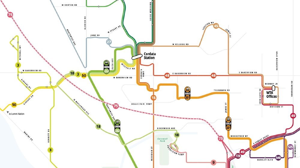
It was a good opportunity to think about this part of W. Bakerview Road, an important and busy east-west arterial across Bellingham’s north side, as a frequent transit corridor. In addition to Route 232, the spine of the Green GO Line, Routes 3, 18, and 50 now feed into Cordata Station, WTA’s north side Bellingham transit hub, via W. Bakerview Road west of Eliza Avenue.
With June’s service changes, Route 50, which connects Lummi Nation to Bellingham, now terminates at Cordata Station instead of Downtown Bellingham. While that switch may better connect Route 50 riders to Cordata-area shopping, for those heading into Downtown Bellingham from Lummi Nation via transit, a transfer is now required. While on paper, Route 232 may seem like a logical choice, the transfer environment isn’t ideal. From the 50’s eastbound stop at W. Bakerview Road & Fred Meyer, it’s a two-tenths of a mile to walk over to the 232’s stop at Northwest Avenue & W. Bakerview Road.
Transfers farther east on W. Bakerview Road are technically possible, but also not ideal. While the eastbound and westbound stops at W. Bakerview Road & Palisade Way — all served by Routes 3, 18, 50, and 232 — are more or less across the street from one another, there’s no crosswalk to safely cross four lanes of traffic and a bi-directional center turning lane. The speed limit here is 35 mph. Meanwhile, the stops at W. Bakerview Road & Eliza Avenue are about one-tenth of a mile from the busy arterial intersection’s signalized crosswalks.
Transferring from a Cordata-bound Route 50 bus to a downtown-bound bus should probably happen at Cordata Station itself. Perusing weekdays and Saturday schedules, it looks like the 50’s scheduled arrivals at Cordata are well-timed for the departure of downtown-bound Route 15 buses. Going that way is more direct than backtracking on W. Bakerview Road on the 232 before heading downtown on Northwest Avenue.
While the City of Bellingham and WTA could, in theory, collaborate to improve bus stops along W. Bakerview Road to create more appealing places to transfer buses, that’s not going to do much to reduce the high levels of arterial traffic. In addition to motorists heading to and from W. Bakerview Road outposts of Costco and Fred Meyer, last fall, the City of Bellingham approved a Chick-fil-A restaurant, including a drive-thru, for a large parcel of land at W. Bakerview Road & Cordata Parkway. Anticipate years of additional traffic madness in this part of Bellingham baked into that vehicle-centric permit approval.
Route 18 to Hospital via Maplewood Avenue
To continue my clockwise transit trek, I fortunately didn’t have to wait too long at W. Bakerview Road & Eliza Avenue for the Route 18 bus heading to PeaceHealth St. Joseph Medical Center. On paper, this route may look somewhat strange. From the Cordata area, it runs west on W. Bakerview Road past Fred Meyer and Costco before turning back, southeast on W. Maplewood Avenue and east on Birchwood Avenue toward the hospital campus, where it terminates and offers a transfer point to Route 9, adjacent to the hospital’s main entrance.
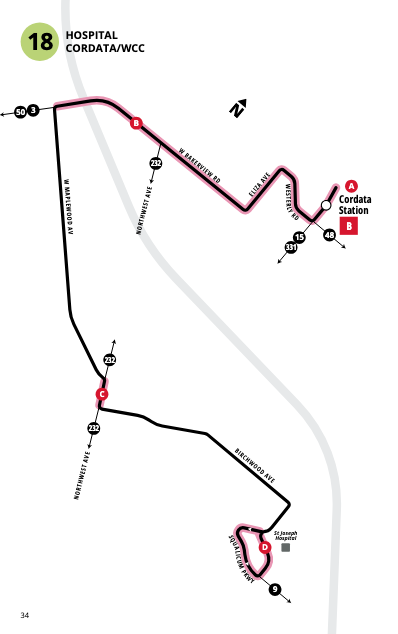
As part of the June service changes, WTA split the underperforming, meandering, and sluggish Route 4 into two new routes, the 9 between Downtown Bellingham and the hospital via Sunnyland, and the 18 for the remainder of the route between the hospital and Cordata via the Birchwood neighborhood. Since the Birchwood Avenue and W. Maplewood Avenue corridor serves more transit-dependent and under-resourced communities, including the Birchwood food desert, Route 18 provides important connections to services, grocery stores, and other shopping near the Cordata Station and along W. Bakerview Road, plus the hospital.
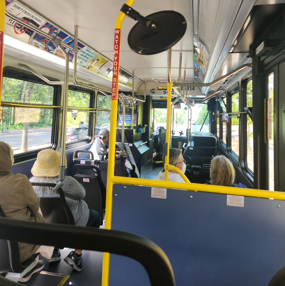
On last week's transit adventure loop around Bellingham, Route 18 was the busiest bus I encountered, which is a good sign. Along Maplewood Avenue, it was great to see a long stretch of newly poured sidewalks adjacent to the City of Bellingham’s Storybrook Park, currently under development.
Since I wasn’t in a particular hurry, instead of taking Route 18 all the way to its terminus at the hospital, I hopped off at Birchwood Avenue & Meridian Street to walk through Cornwall Memorial Park en route to Route 9. The hospital isn’t too far from the eastern entrance of the park at Coolidge Drive. (Route 15 on Meridian Street also offers access on the west side of the park.)
Cornwall Memorial Park is a wonderful oasis of towering trees, walking paths, and trails. Compared to waiting for the bus in the direct sun on W. Bakerview Road in Cordata, the park was noticeably cooler and certainly far removed from busy and noisy arterial roadways.
Route 9: Hospital to Downtown via Sunnyland
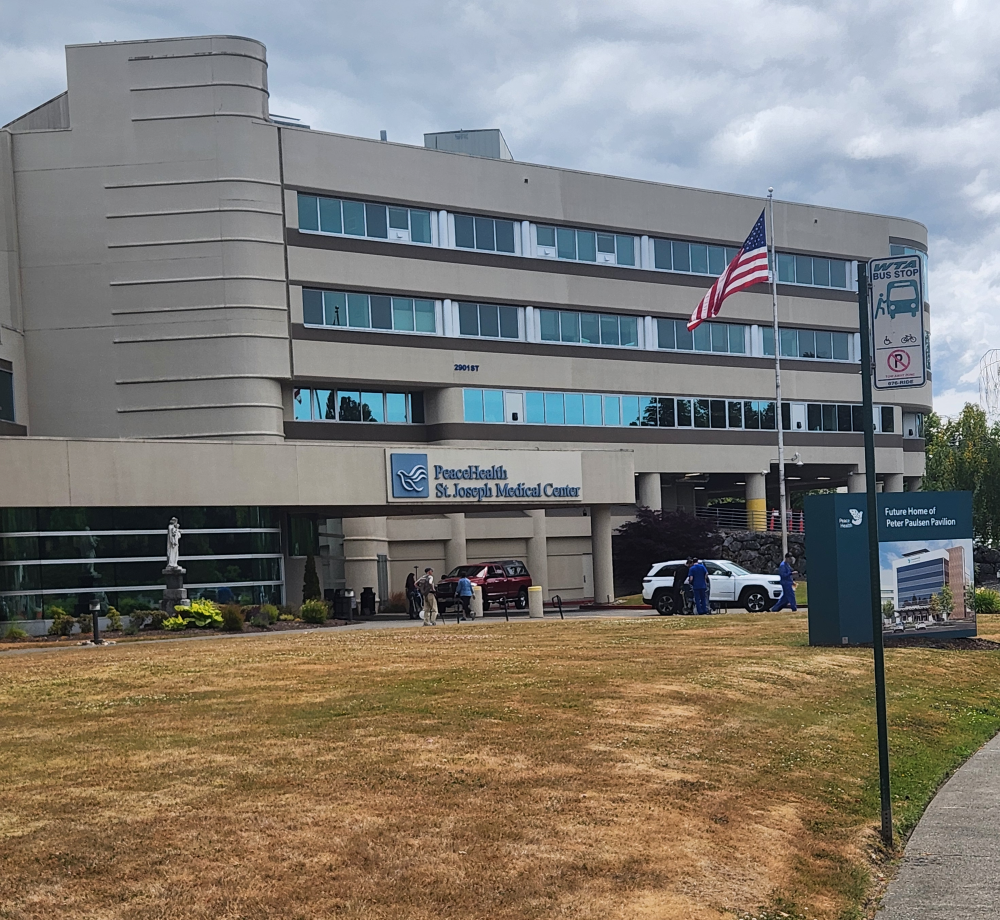
PeaceHealth St. Joseph Medical Center, Whatcom County’s largest employer and Washington’s only hospital north of the Chuckanut Mountains, has been challenging to serve via transit given its location in Bellingham. The hospital campus is partially hemmed in by Squalicum Creek and Interstate 5 on the north and east while also being located away from major arterial roadways to the south and west. Unless Bellinghamsters are headed to the hospital, there are few good reasons to travel through the medical center campus on the way somewhere else.
During my atypical transit loop tour of Bellingham, I found myself waiting with three other people for a Route 9 bus outside the hospital's main entrance.
Hospitals and major medical facilities are usually significant drivers of transit ridership. But that hasn’t necessarily been the case in Bellingham. Route 4, which only served the hospital once an hour Mondays through Saturdays, was an underperforming route.
It had numerous twists, turns, and even a dead-end deviation — with speed bumps — on Levin Lane in order to serve The Willows retirement residence. Eliminating this low-ridership detour, I suspect, was the most difficult route-realignment and stop-consolidation pill to swallow with the June service changes. It’s never great removing transit service from a retirement complex but removing the Levin Lane detour certainly speeds up buses between downtown and the hospital. As the Cascadia Daily News reported in December, WTA planning director Tim Wilder said during a WTA Board of Directors meeting that based on farebox data, only one person was boarding at The Willows every other day.
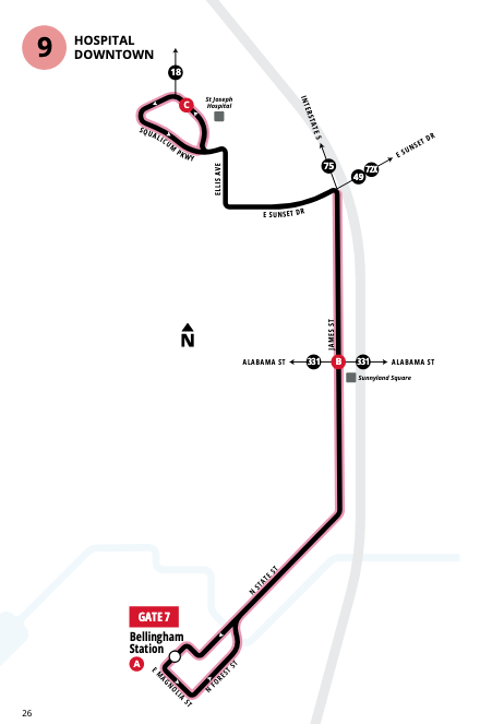
Compared to Route 4, the new Route 9 has service every 30 minutes on weekdays and buses once an hour on weekends. You can now reach the hospital campus via transit on a Sunday! Instead of Route 4’s low-ridership meander through the Broadway Park Historic District, Route 9 has a more direct north-south pathway through the Sunnyland neighborhood via James Street.
If service on Routes 49, 72X, and 75 were more frequent, the James Street corridor through Sunnyland could, essentially, host a new GO Line, making this part of Bellingham one of the most transit accessible in the city, bolstering Route 331 buses on the Gold GO Line frequent service corridor on Alabama Street.
With weekday service every 30 minutes on Route 9, supplemented by additional bus trips on Routes 49, 72X, and 75, you can quickly zip up James Street from downtown by bus and reach Trader Joe’s at the Sunnyland Square shopping center, skipping TJ’s legendary parking headaches. While Bellingham’s second Trader Joe’s location in Cordata — which recently opened, complete with a local marching band celebration — is within walking distance of WTA’s Cordata Station, there’s more adjacent transit access at the Sunnyland location, especially with Route 331 on Alabama Street.
While no marching band came out to trumpet the launch of WTA’s transit expansion this past week, there’s another good reason to celebrate the introduction of Route 9 in Sunnyland: The stops at James Street & Kentucky Street, complete with adjacent push-button crosswalk beacons, are an important gateway to some of the best food and beer in Bellingham, including Otherlands Beer, Stemma Brewing Co.’s two locations, and El Sueñito Brewing Co.
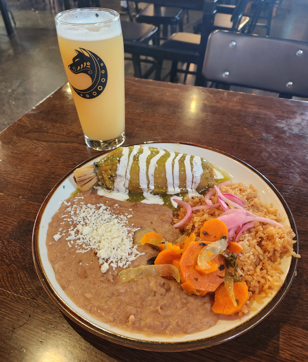
Since my earlier plan to have some pupusas for lunch at Bakerview Square didn’t pan out, I opted instead to have a tamale plate lunch at El Sueñito, which is co-located with Frelard Tamales. Weekdays 11 a.m.–2 p.m., Frelard offers a one tamale plate lunch special, which comes with rice and beans, for $13.99. With boosted transit service on James Street, that makes weekday lunch outings to this corner of Sunnyland more easier to swing for workers downtown and at the hospital.
Early Lessons From WTA’s Service Expansion
Heading back downtown from El Sueñito, the next bus on James Street wasn’t Route 9 but the 49, which offers an irregular schedule on a route serving WTA headquarters off Bakerview Spur. Although it’s a quick trip to Bellingham Station by bus from James Street & Kentucky Street, it underscored the joys that come with a simple transit trip along a key corridor. I’ve previously walked back to Bellingham Station from El Sueñito and Otherlands in Sunnyland numerous times before, but the walking environment along N. State Street is far from ideal. The bus is a far better experience.
Boosting bus service along non-frequent transit corridors like W. Holly Street through Old Town and James Street in Sunnyland are the types of investments needed to support denser housing in Bellingham and lower the barriers where hopping on a bus is an easier choice for making trips around town, especially to and from downtown.
Since transportation-related emissions comprise the biggest share of Bellingham’s carbon footprint, getting more Bellinghamsters to use WTA buses instead of driving should be at the top of the list of local priorities for the city to pursue its carbon-reduction goals.
WTA’s four existing GO Lines, now 20 years old, have already created a strong frequent transit network in Bellingham weekdays and Saturdays, with service every 15 minutes for most of the day. (On Sundays, there’s less service frequency on many WTA routes.)
Something that may get lost in the details of WTA’s new schedules and service expansion: While it’s currently not feasible for WTA to bring every route in Bellingham up to a 15-minute frequency standard, with June’s service expansion, nearly all the transit corridors feeding into Downtown Bellingham now have service at least every 30 minutes during weekday mornings and afternoons. (The only one that doesn’t is the portion of the Route 196/197 loop going to and from Bellingham Station east into the York neighborhood toward the Civic Athletic Campus via Meador Avenue.)
These are all steps in a good direction that will serve most existing WTA riders well, hopefully build more transit ridership in Bellingham, reduce local car dependency, and keep congestion in check as the city grows.