Thinking Back on DIY Transit Arrival Information Displays From an Earlier Era

Let's make real-time transit arrival information “an extension of your central nervous system.”

In their recent newsletter edition, Walk & Roll Bellingham highlighted do-it-yourself LED transit arrival displays developed by Eastside Urbanism and demonstrated during a recent workshop in Redmond. Walk & Roll, inspired by these open-source efforts, is organizing a party with Strong Towns Bellingham to build them locally. (Click here for more info if you’re interested.)
Seeing photos of those DIY transit information displays made me smile for a couple reasons. One, they’re cool. Two, they provide another way to connect useful transit information with existing riders and potential users when situated in transit-accessible places where the public gathers, like coffeeshops, cafes, and breweries.
But they also make me think back on much earlier examples of DIY transit arrival information applications back east in Washington, D.C.
In a Washington City Paper cover story in October 2010, I explored the introduction of Nextbus transit arrival information in the nation’s capital and how the D.C. area became “a region of logistics obsessives” — I shadowed one particularly transit-savvy D.C. Council member as part of my reporting — navigating local transit with their smartphones.
But I also looked back at an early DIY effort five years earlier through something called Last Call, developed by D.C. web developer Tom Lee.
As I wrote in “The App Trap” in Washington City Paper, where I served as deputy managing editor 15 years ago:
D.C.’s first popular cellphone-based transit-arrival prediction tool ran off of a cheap Nokia cellphone with a cracked screen in Tom Lee’s apartment in Shaw. In late 2005, Lee took published train schedules from Metro’s RideGuide and plugged them into a text-based SMS service. You could text in a station name, and in Lee’s apartment, the crappy cellphone would spit back the scheduled arrival time.
Lee released his system, dubbed Last Call, in December 2005, as part of a public service from DCist.com. Soon, Lee could sit at home on a Saturday night and see the crappy cellphone flash every time somebody texted Last Call for information — hundreds of requests over the course of the average weekend. (Disclosure: I co-founded DCist in 2004.)
Lee’s apartment, a short walk from a Metrorail station, also featured a novel display board with red, yellow and green lights:
A green light meant there was enough time before the next train for him to walk from his apartment to the Mount Vernon Square Metrorail station “at a comfortable pace.” Yellow indicated that time was running out to make the next train. Red meant the opportunity to catch the next train had passed.
But this rudimentary attempt 20 years ago to make transit information more digitally accessible to Metro passengers in D.C. was short lived:
Alas, Last Call was unstable, its information imprecise and error prone. Last Call was dead within a few months; today’s technology makes SMS-based transit information look about as modern as a telegraph. But it was clear that the delivery of transit information was a public good worth fighting for. Over the next few years, activists lobbied Metro to release more of its transit data. Among the results: NextBus-enabled cellphone apps. “All of these efforts are part of making the city an extension of your central nervous system,” Lee says.
Twenty years later, Lee’s quote about the real-time transit information as “an extension of your central nervous system” continues to ring true.
While we all have real-time transit arrival information readily available through smartphone apps, like Transit App and, more locally, WTA’s BusTracker app, physical displays of transit arrival information — whether they’re through large durable vandal- and weather-resistant screens at major stations or these new DIY versions you can construct at home — help integrate useful transit information into the civic architecture around us. They not only help inform transit riders. When positioned in advantageous locations, they also remind others who normally drive that there are reliable transit alternatives nearby.
We’ve come a long way since earlier eras of transit use that were reliant on paper schedules and subject to real-time information voids about bus and train locations. While "ghost buses" continue to be a problem for many transit agencies, in my experience, WTA's BusTracker app is very reliable. When used in conjunction with other transit information tools, like Transit App and Pantograph (where you can figure out how many minutes behind schedule a bus is), you can be assured that, yes, the bus is coming.
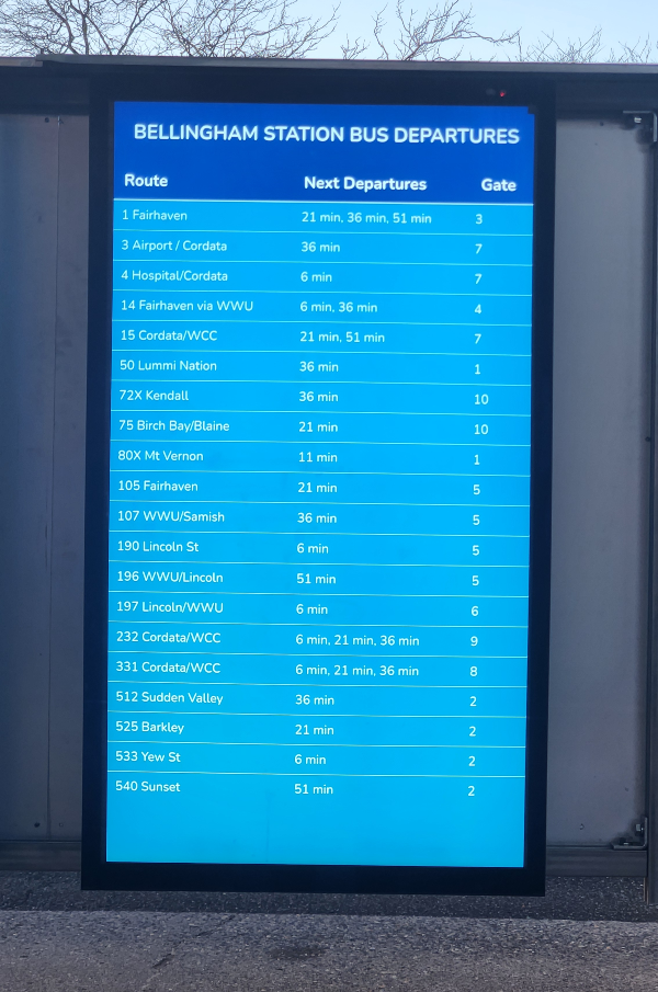
While it may be cost prohibitive for WTA to deploy vandal- and weather-resistant transit arrival display boards at bus stops across Bellingham — the ones installed on the Bellingham Station concourse last year are nice, though they show scheduled departures, not necessarily real-time information — it’s not hard to envision these lower-cost DIY versions deployed at certain transit-accessible coffeeshops, cafes, grocery stores, taprooms, library branches, or the lobby of the Fairhaven Transportation Center.
Imagine sitting in a spot like Makeworth Coffee Roasters on N. State Street & E. Chestnut Street with a one of these DIY transit screens displaying the next arrivals for WTA’s Route 1 bus to Fairhaven or ROAM Coffee + Beer at Broadway & Elm Street with a display showing the next Downtown- and Cordata-bound bus arrivals for Route 232 on the Gold GO Line or Route 15 nearby on Meridian Street.
Imagine Bellingham municipal officials and personnel at City Hall having better access to real-time bus information on-site so they can more easily use transit instead of having to drive somewhere 5 or 10 minutes away from Lottie Street where they may end up struggling to find parking.
The more that Bellinghamsters encounter real-time transit information in the places they regularly patronize, gather, and visit, the more likely they’re going to remember that they don’t necessarily need to drive there.