Planning a Car-Free Visit to Bellingham Using WTA Buses

You don't necessarily need a car to visit and enjoy the best of what the Bellingham has to offer.

Leave the car keys at home and unlock the City of Subdued Excitement with transit.
Attention Bellingham visitors: You don't necessarily need a car to visit and enjoy the best of what the City of Subdued Excitement has to offer.
If you've navigated transit systems in other cities, know how to check route schedules and real-time arrival information via a smartphone, and don't mind walking to some destinations, navigating Bellingham via Whatcom Transit Authority buses should be fairly straightforward. If you do bring a car to Bellingham, you can certainly leave it parked someplace while you explore the city on foot, bike, or via various WTA bus routes. And if you've come to Bellingham to explore the abundant collection of excellent local breweries, perhaps you shouldn't be driving around town?
While it may require a little planning and keeping an eye on bus schedules, you may discover that the local transit network here can unlock most of the best places and experiences Bellingham has to offer. And at $1 a ride, riding a WTA bus is certainly cheaper than summoning a rideshare or taxi, paying for a car rental, or paying for parking.
The Basics
Looking at a WTA route network diagram of bus service in Bellingham, it may initially look confusing and perhaps intimidating. It's certainly not a bus grid, thanks to the city's topography and multipolar nature. (In 1903, the separate cities of Fairhaven and New Whatcom, which encompassed the earlier merger of Sehome and Whatcom, consolidated into the City of Bellingham.)
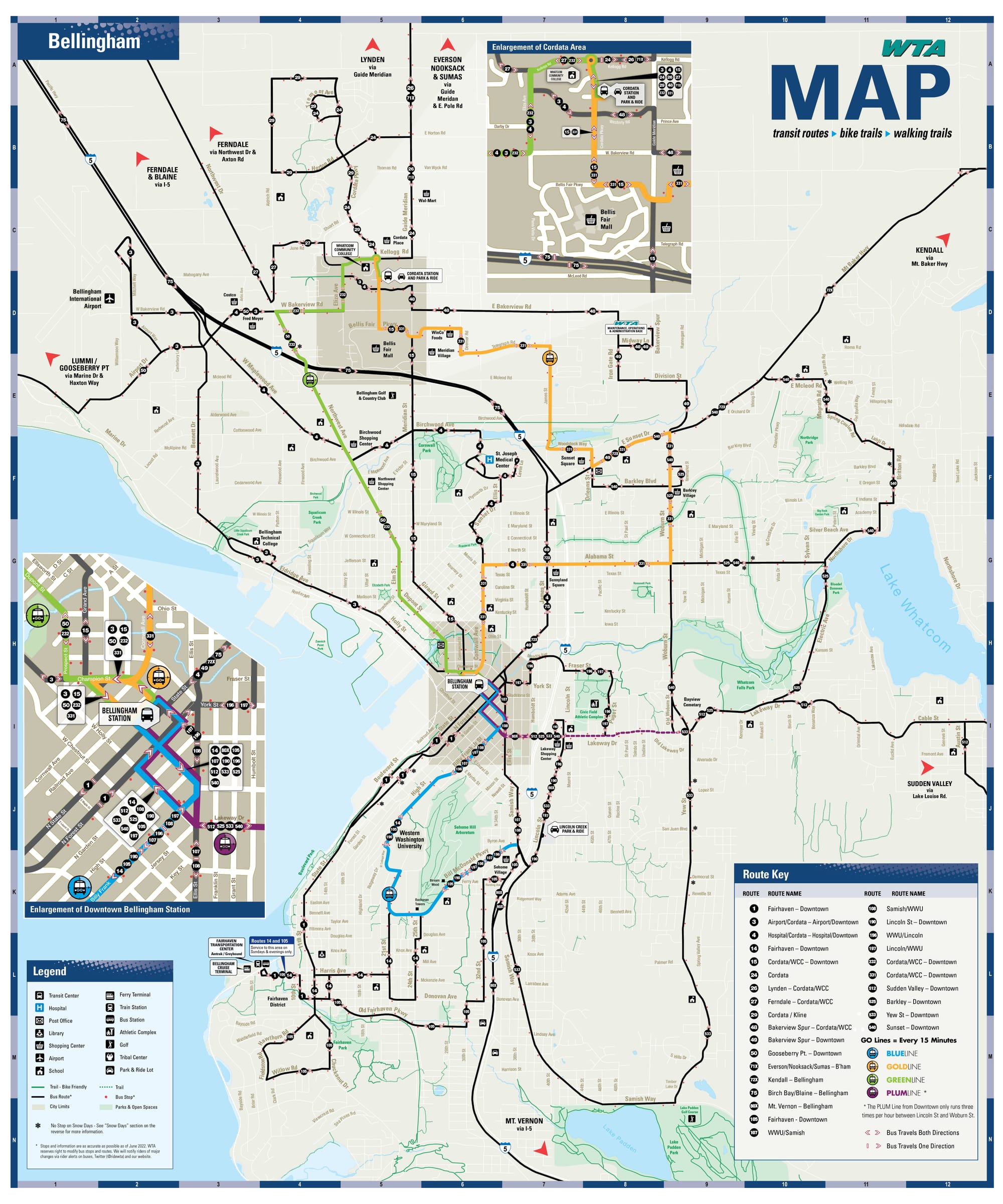
Anchored by Bellingham Station in the northeastern corner of Downtown Bellingham, the WTA's bus network has major nodes to the south in Fairhaven, where the Amtrak station is, and in the north at Cordata Station, near Bellis Fair Mall. The result, practically speaking, is that there are multiple routes connecting Bellingham Station with Fairhaven and Cordata Station, they just take very different and sometimes indirect routes to end up at the same destination. For instance, Routes 1, 14, and 105 all connect Downtown Bellingham with Fairhaven, but Routes 14 and 105 run up to Western Washington University on Sehome Hill and serve different parts of the Happy Valley neighborhood.
Bellingham's Topographical Quirks
One of the reasons why the WTA bus network may look strange is because the heart of Western Washington University, the largest destination in the WTA bus network, sits approximately 300 feet uphill from Downtown Bellingham, part way up the 620-foot Sehome Hill, a large arboretum that rises behind the university. The university's topographical realities necessitate most bus routes serving campus have to hook around the south flank of the arboretum to reach Sehome Village, a major shopping hub adjacent to Samish Way and Interstate 5.
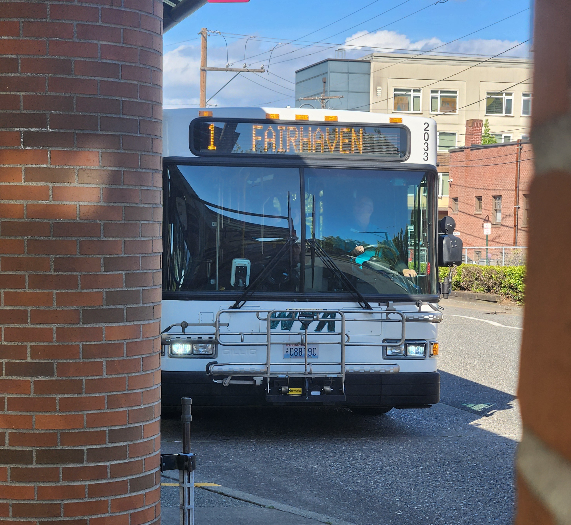
Route 1 Is the Most Useful WTA Line for Visitors
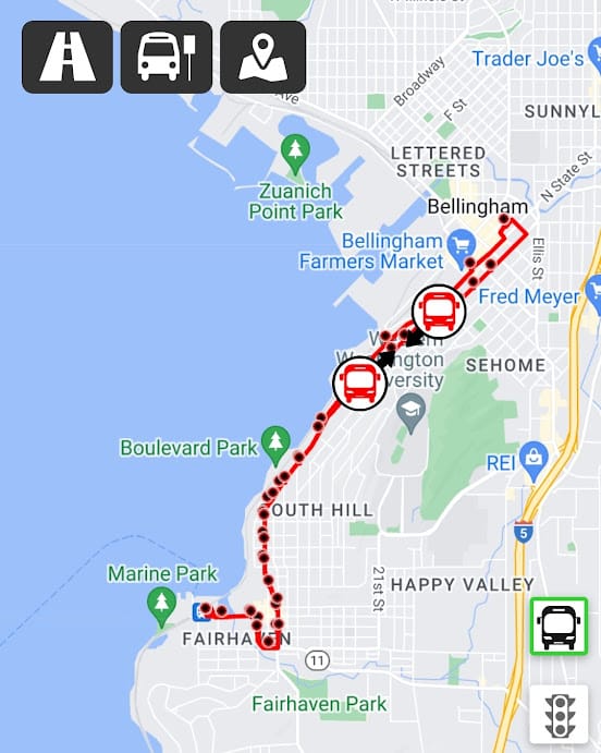
Practically speaking for car-free or car-lite visitors exploring the City of Subdued Excitement, Route 1 connecting Downtown Bellingham and Fairhaven is the most useful bus line in the city, especially for those who arrive in Bellingham via Amtrak Cascades buses and trains at the Fairhaven Transportation Center and/or are either staying at the Fairhaven Village Inn in Fairhaven or the Hotel Leo in Downtown Bellingham.
Route 1 also provides a scenic trip along the bluffs of Bellingham Bay. (While Route 1 serves the Amtrak station at all times, on evenings and Sundays, two additional WTA routes that serve Fairhaven, Routes 14 and 105, terminate at the Amtrak station along with Route 1.)
Even if you drive to Bellingham, you might want to hop Route 1 to reach Boulevard Park and Taylor Dock since adjacent parking can be scarce, especially when the weather is pleasant and there's a nice sunset.
Downtown Transfers
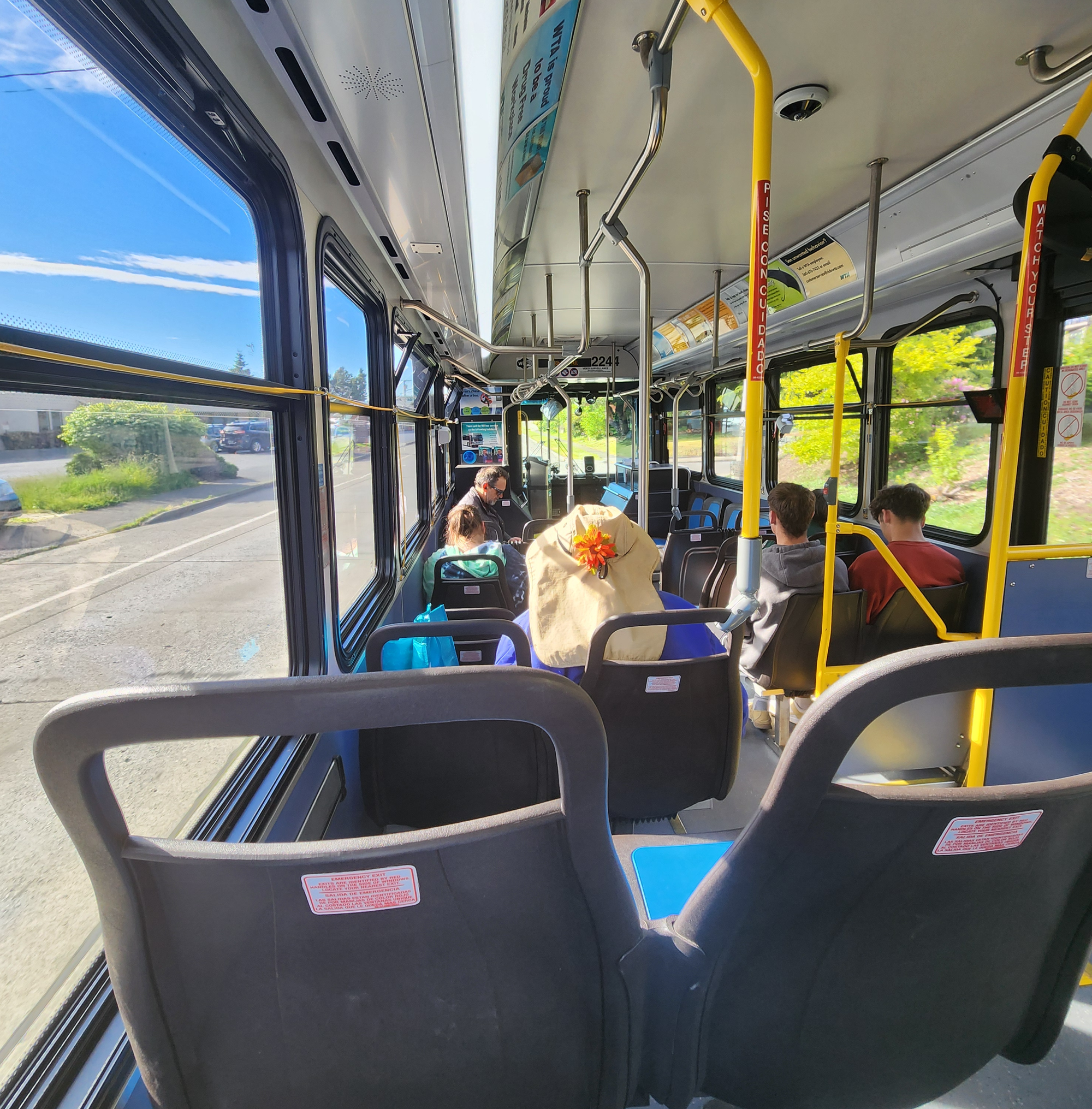
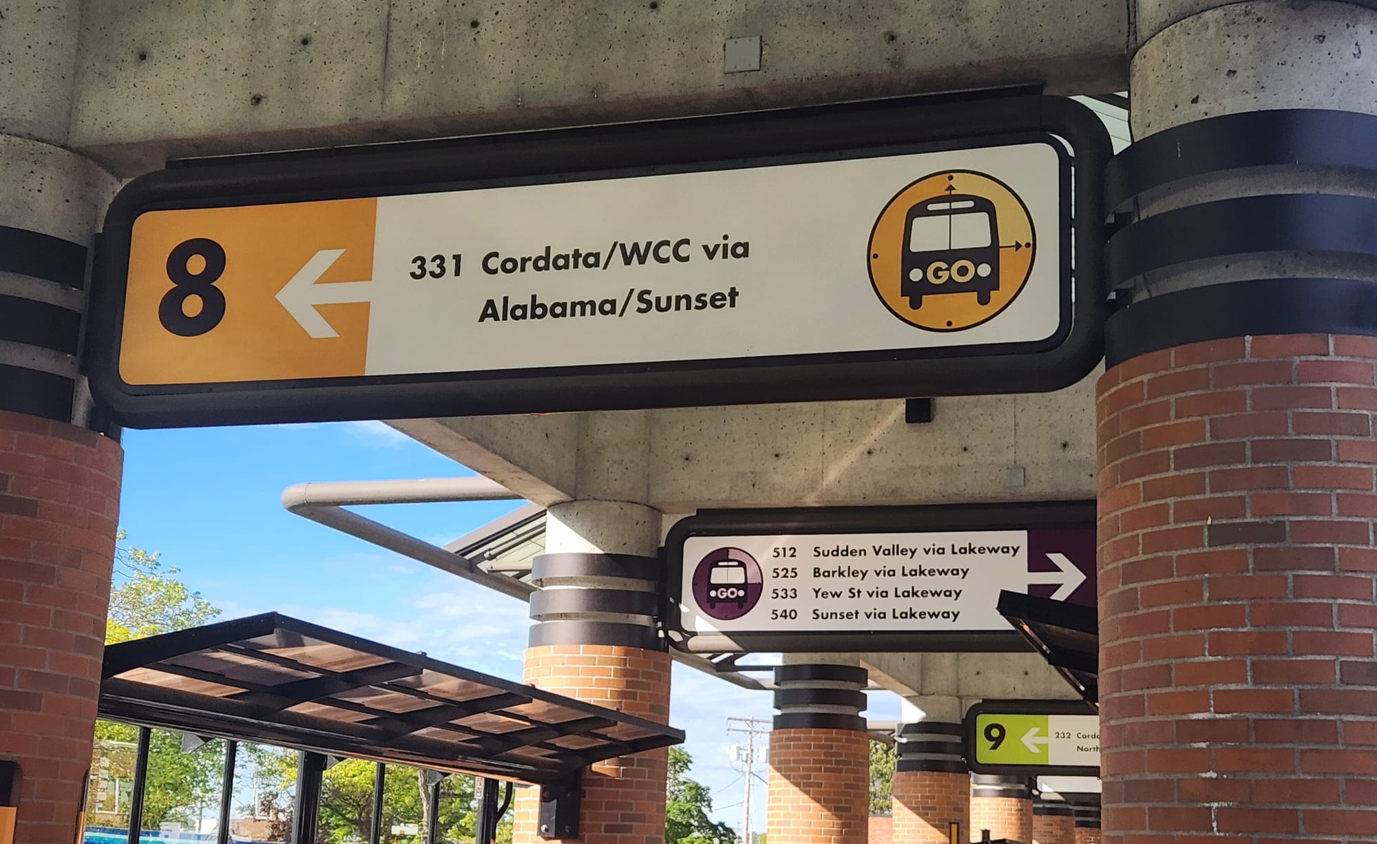
Many WTA bus trips require a transfer at Bellingham Station, located at Railroad Avenue & E. Magnolia Street in Downtown Bellingham, but thanks to the WTA's scheduling, where many routes start and end their trips from the same hub around the same times, many transfers downtown are well timed. There aren't free transfers between lines — unless the bus continues as a different route, like Route 14 turning into Route 15 at Bellingham Station — so getting a $3 day pass (or using the Umo Mobility app or farecard which automatically incorporates daily and monthly fare-capping) can be a good deal if you're making a roundtrip that includes a transfer downtown on the way there and back. The individual bus bays and route destinations served are clearly marked at Bellingham Station, but if you're confused where you're supposed to go, WTA staff at the information booth are usually available to point you in the right direction.
WTA GO Lines
When looking at individual WTA bus route schedules, savvy transit users might be disappointed by the lackluster service frequency on many lines, in many cases, routes with only one bus per hour. While that isn't ideal, looks can be deceiving. In many cases, multiple WTA routes serve common corridors called "GO" lines, where the combined service frequency brings buses by approximately every 15 minutes for much of the day.
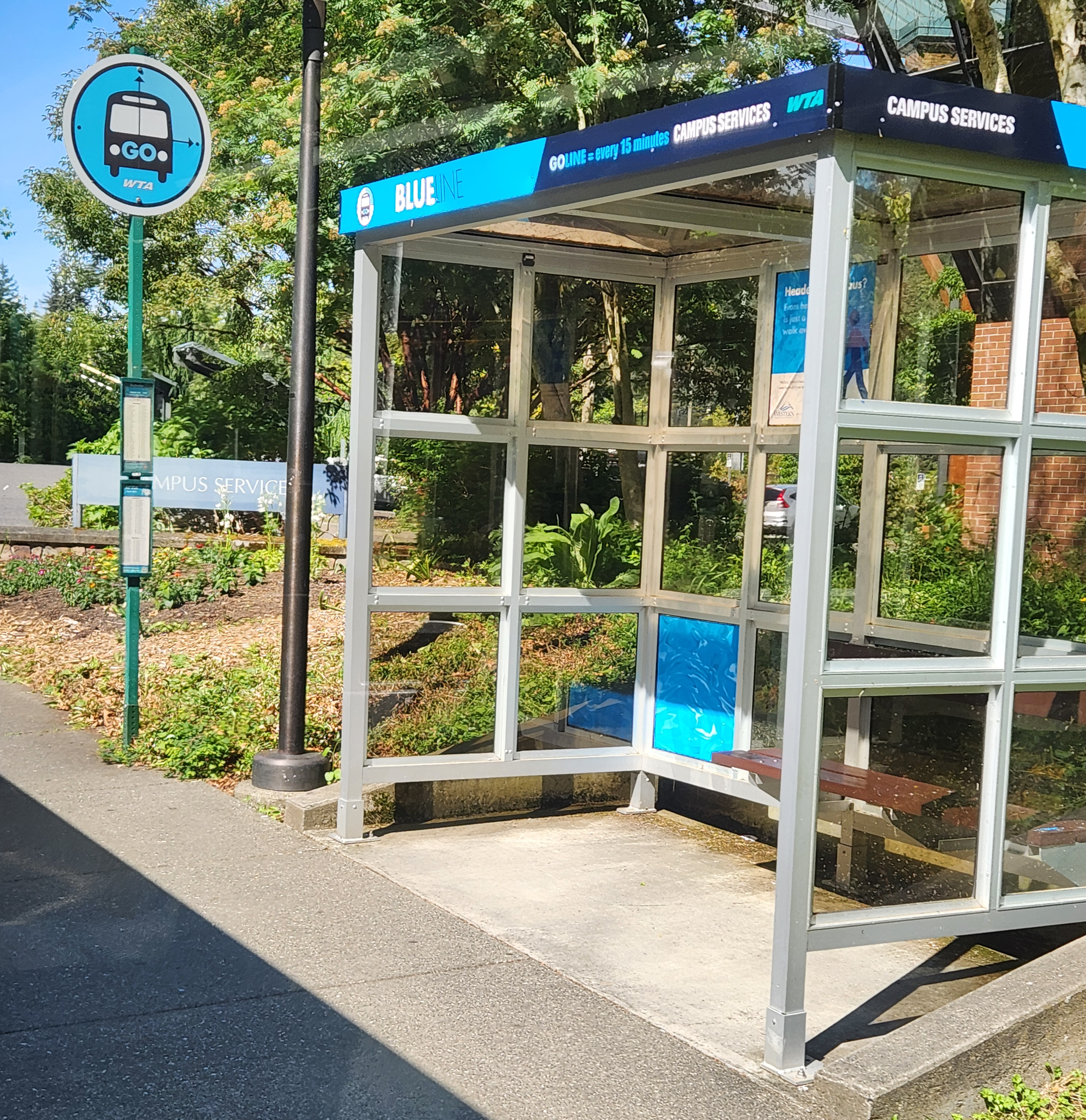
- The 100-series buses (Routes 105 and 190, plus the looping Routes 107/108 and 196/197), plus Route 14 converge on the Blue GO Line corridor serving Western Washington University via High Street, which is only open to buses through campus, and Bill McDonald Parkway, which serves many apartment complexes and WWU student housing south of Sehome Hill. Given limited parking options near the WWU Performing Arts Center, Viking Union, and Red Square academic buildings, the Blue GO Line bus routes are the best way getting up to campus.
- Routes 232 and 331, which form the backbones of the Green and Gold GO Lines, respectively, both connect Bellingham Station and Cordata Station, with service approximately every 15 minutes for much of the day. While Route 232 connects them more directly via the Green GO Line corridor through the Lettered Streets and along Northwest Avenue, Route 331 has a far more indirect route, with numerous turns to reach the Barkley Village and Sunset Square shopping centers via Cornwall Avenue, Alabama Street, and Woburn Street and the Bellis Fair Mall on the northern suburban fringes of the city via James Street, Telegraph Road, and Bellis Fair Parkway.
- Some of the 500-series Plum GO Line routes, which run east out of Downtown via Lakeway Drive, can be useful for reaching some of Bellingham's great parks including Whatcom Falls Park (Routes 512 and 525 via Lakeway Drive), Bloedel Donovan Park on Lake Whatcom (Route 525 and 540), Lake Padden Park (Route 533 via Yew Street), and the Stimpson Family Nature Reserve (Routes 512 via Sudden Valley).
Despite the WTA's colored GO Line corridor branding, bus destination signs don't denote their GO Line affiliation. (So don't go searching for "the Blue GO Line bus" since multiple bus routes serve the Blue GO Line.)
Fares and How to Pay
Compared to larger cities like Seattle, Whatcom Transit Authority fares are a bargain and include daily and monthly fare-capping when using an Umo Mobility app or farecard. Local routes are $1 per ride (the intercounty connector Route 80X, linking Bellingham with Mount Vernon in Skagit County, costs $2 per ride for trips that cross the county line.
Check out the WTA's fare information page for full details.